Königsstuhl Project

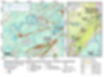
Figure 1: Overview of Mustang Energy's Königsstuhl Project (7),(1)
Highlights
-
Ownership: The Königsstuhl Project is 100% owned by Mustang Energy .
-
Size: 5,228 hectares across 5 claims.
-
Location:
-
The project is located approximately 25 kilometers northwest of Cameco’s McArthur River Mine and 45 kilometres southwest of Cameco’s Cigar Lake Mine.
-
-
Nearby property mineralization (see Figure 1):
-
Drill hole WMA-010 intersected 0.29% U3O8 over 0.5 m from 881.3-881.8 m, with anomalous Pb, V, Co, Ni, As, in a bleached, clay-altered fault in graphitic pelite1. (SMDI# 3553)
-
Drill hole WMA-004 intersected 0.28% U3O8 over 0.2 m from 1016.0 - 1016.2 m four metres below the Athabasca unconformity associated with a clay-filled fracture in hematite-chlorite paleoweathered semi-pelite2. (SMDI# 3551)
-
Drill Hole CL-138 intersected 547 ppm U(partial) over 0.5 m from 609.3-609.8 m in pelite below the unconformity at 606.6 m3. (SMDI# 3549)
-
-
Previous Work:
-
The property benefits from extensive high-resolution geophysical coverage including a 2011 ZTEM survey over the southern claim area4, a 2005 MEGATEM survey across the northern claim block5, and a 2005 Radiometric survey covering the entire property. (6)
-
Overview
The Königsstuhl Project is strategically positioned in the Eastern Athabasca Basin, one of the world’s most productive uranium regions, and consists of five claims covering an area of 5,228 hectares. The project is located approximately 25 kilometers northwest of Cameco’s McArthur River Mine and 45 kilometers southwest of Cameco’s Cigar Lake Mine.
The geological setting of the Königsstuhl Project demonstrates potential for the discovery of unconformity-style and basement-hosted uranium mineralization. The property features EM conductors and mapped faults identified through previous exploration3,4 which can serve as both conduits and traps for uranium mineralization.
References
(1) Saskatchewan Mineral Deposits Index, SMDI# 3553, Retrieved from: https://mineraldeposits.saskatchewan.ca/Home/Viewdetails/3553
(2) Saskatchewan Mineral Deposits Index, SMDI# 3551, Retrieved from: https://mineraldeposits.saskatchewan.ca/Home/Viewdetails/3551
(3) Saskatchewan Mineral Deposits Index, SMDI# 3549, Retrieved from: https://mineraldeposits.saskatchewan.ca/Home/Viewdetails/3549
(4) Saskatchewan Mineral Assessment Database, SMAD# 74H-0061, Retrieved from: http://mineral-assessment.saskatchewan.ca/Pages/BasePages/Main.aspx
(5) Saskatchewan Mineral Assessment Database, SMAD# 74H14-0056, Retrieved from: http://mineral-assessment.saskatchewan.ca/Pages/BasePages/Main.aspx
(6) Saskatchewan Mineral Assessment Database, SMAD# 74H-0061, Retrieved from: http://mineral-assessment.saskatchewan.ca/Pages/BasePages/Main.aspx
(7) Saskatchewan GeoAtlas, Retrieved from: https://gisappl.saskatchewan.ca/Html5Ext/index.html?viewer=GeoAtlas
Disclaimer
The scientific and technical information in this website has been reviewed and approved by Lynde Guillaume, P.Geo., Technical Advisor for Mustang Energy Corp. Ms. Guillaume is a Qualified Person as defined under the terms of National Instrument 43-101. This website refers to neighboring properties in which the Company has no interest. Mineralization on those neighboring properties does not necessarily indicate mineralization on the Company’s properties. Some Project descriptions refer to historical sample results and drill holes both off- and on-property. Mustang considers this information to be relevant to exploration; however, these results have not been physically verified by Mustang’s Qualified Person.